Listen Live

Little boat with a big job: PSF’s ‘Wilbur’ mapping the Island’s eastern shoreline

The Pacific Salmon Foundation has a special boat collecting coastline data to help wild salmon this summer.

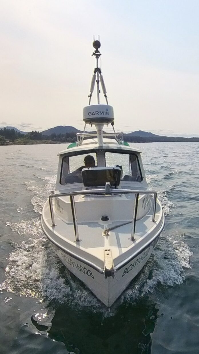
It’s kind of like the Google Maps car, but for the shoreline.

The 16-foot research boat “Wilbur” is currently near Port McNeill, after spending the last week mapping shorelines between Comox and Campbell River.

The foundation says the data Wilbur is collecting is part of the Resilient Coasts for Salmon program. The team is mapping what’s known as coastal hard armouring along the entire east coast of Vancouver Island. Protecting shorelines with rip-rap and other hard barriers prevents erosion, but can restrict salmon habitat.

The boat is capturing 360-degree and high-resolution photos. The data will help make sure the health of shorelines is considered in future decision-making.

Continue Reading

cjsu Now playing play

- Advertisement -

Related Articles

- Advertisement -

Latest News

Ribbon-cutting ceremony welcomes new recovery centre in North Cowichan 

A new recovery centre in North Cowichan was welcomed by dignitaries and supporters at an event yesterday (Sept. 12) on Norcross Road.

Herd Road re-opens to public traffic after months of construction 

Herd Road is going to be ready to open to traffic starting on Sept. 16.

Ladysmith residents sweepingly approve of Spring Clean-Up service 

Half of respondents approved of the Town of Ladysmith's handling of the Spring Clean-Up program.

More Shaikh Al Kar products recalled in B.C. due to salmonella

A recall of Shaikh Al Kar products due to possible salmonella contamination is expanding in British Columbia. 

More Shaikh Al Kar products recalled in B.C. due to salmonella

A recall of Shaikh Al Kar products due to possible salmonella contamination is expanding in British Columbia. 
- Advertisement -