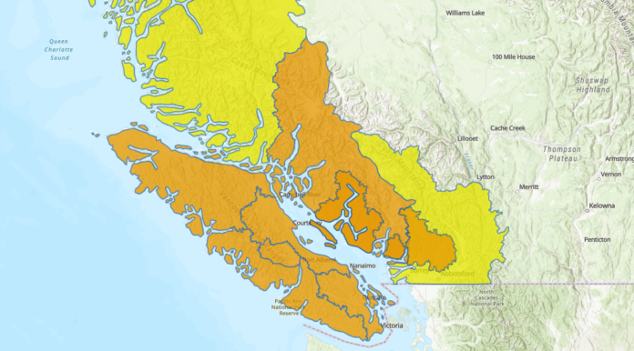
Environment Canada says the Island and Coast is in for some more wet weather starting Friday, and freezing levels are also supposed to rise.
Warning preparedness meteorologist Lisa Erven says the area will see a few different storms heading for the coast. At least two look like atmospheric rivers, and rain will be heavy into mid-next week.
Along with the rain, freezing levels are projected to increase up to 2,500 metres which will not benefit local ski resorts. For example, Mount Cain on the North Island has closed once again after only opening briefly.
“It’s definitely an unfortunate weather system coming through. Anytime we have storms approaching from the southwest or coming in the form of an atmospheric river, that’s really tapping into tropical moisture and heat,” said Erven.
“[Freezing levels] may fluctuate here and there with each passing storm itself, but in general remaining quite elevated.”
A statement from the Ministry of Emergency Management and Climate Readiness says Inland Vancouver Island could expect as much as 150 mm of rain between Jan. 27 and Jan. 31. The high freezing levels may be a concern for local ski resorts, with Mount Cain closing once again this season.
The province says the heavy rainfall mixed with snow melt could put a lot of pressure on B.C.’s river systems and potential flooding. They add wet ground mixed with wind could lead to power outages.
Environment Canada has also issued a special weather statement for the area, warning of landslides, falling trees and travel delays.
Flood watches are in place for the Island and Coast, and the River Forecast Centre says peak levels are expected between Sunday and Tuesday. However, that could extend from Tuesday to Thursday for lake-driven rivers.
The province says you should take steps to protect your home by ensuring drainage is clear. Sandbags may also be a good idea. They add you should make grab-and-go bags, recognize danger signs such as a rapid change in water level, stay away from shorelines and drive safely.
“I urge people to stay tuned to their local weather forecast as we’ll be providing more and more details on the exact amount of rain coming for each one of these storms, the winds coming,” said Erven. “Between our alerts and the River Forecast Centre, please do stay informed.”
Erven adds you should check DriveBC to make sure road conditions are safe, and BC Ferries in case of sailing cancellations.


